
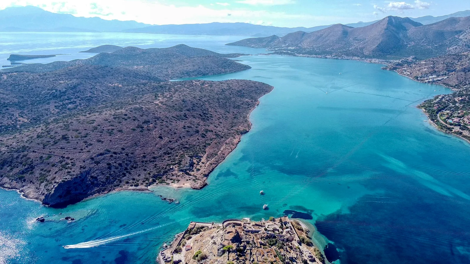
Elounda is easiest to understand from the waterline. The harbor, the shallow lagoon, the road toward the causeway, and the view north to Spinalonga show how geography shaped settlement, work, defense, illness, recovery, and modern travel around Mirabello Bay.
This is not a history that needs decoration. Much of it is visible in plain form: stone, water, salt flats, old routes, and the distance between the shore and the island.
1. Ancient Olous and the Shallow Water
Ancient Olous stood near today’s Poros area, close to the narrow passage between Elounda and the Kolokytha side. The official Spinalonga site describes it as a city-state whose remains are partly submerged in the sea. It also notes that what we know comes mainly from Hellenistic inscriptions and archaeological finds.
That matters for how the place should be described. It is safer, and more honest, to say that Olous connects Elounda with ancient maritime life than to overstate what a visitor can see in the water on any given day. Light, weather, sea conditions, and local guidance all affect what is visible.
The useful point is still strong. Elounda’s coast was not empty scenery. It was part of a settlement pattern shaped by maritime trade, fishing, olive cultivation, and local materials.
2. Salt, Work, and the Lagoon
The lagoon side of Elounda later supported salt production. According to the Ephorate of Antiquities of Lasithi, the salt pans may have existed from the Byzantine period, were used by the Venetians from the early years of their presence in Crete, and became more important after the loss of Cyprus in 1571 and the fortification of Spinalonga in 1579.
The same source explains that the salt pans were not just an industrial detail. Workers came mainly from the villages of Fourni, and the coastal villages of Elounda developed from the land used for their accommodation.
That gives the shoreline a quieter kind of importance. The bay was not only defended or visited. It was worked.
3. Venetian Spinalonga
Spinalonga sits close enough to Elounda and Plaka to remain part of the daily view. The Ministry site records the Venetian decision to fortify the island in 1571, with works beginning in 1579. The aim was practical: protect the harbor, strengthen the area against raids, and support Venetian control of Mirabello Bay.
This was not only a military story. The fortification of Spinalonga was tied to the salt pans, the sheltered harbor, and the need to control movement around Mirabello Bay. The stonework still makes that relationship visible from the coast.
4. Ottoman Settlement
The official history of Spinalonga records that, during the Ottoman period, its port gradually developed into a trading station for ships moving through the southeastern Aegean. It also records periods of conflict between local Christian rebels and Ottoman forces stationed on the island.
This part of the story is easy to oversimplify. Spinalonga was not only a fortress held by one power after another. It also became a settlement, a port, and a place where wider political change in Crete was felt at a local scale.
5. The Leprosy Hospital, 1903-1957
In 1903, the Cretan State decided to isolate people with leprosy on Spinalonga. The official Spinalonga site explains that the choice was shaped by the medical ideas of the period, the abandoned Ottoman houses on the island, and the intention to remove the remaining Muslim population from Spinalonga.
This history needs care. It should not be reduced to a slogan or a sad image. The island was a place of confinement, but also a place where people built forms of daily life within difficult limits. The official account records the role of Epaminondas Remoundakis and the Brotherhood of the Sick in improving conditions, as well as the final closure of the leprosy hospital in 1957. For the wartime layer of this memory, read Elounda, Spinalonga, and Wartime Memory.
6. Modern Visitor Economy
After the leprosy hospital closed, Elounda’s public image changed again. Hotels, coastal roads, boat routes, and the wider promotion of eastern Crete brought new attention to the bay.
That later visitor economy did not erase the older landscape. The same qualities that mattered earlier still matter now: shelter, water, visibility, access to Spinalonga, and the relationship between coast and village. For a focused article on that shift, read How Elounda’s Visitor Economy Changed. For the hotel timeline that followed, see Key Phases in Elounda’s Hotel Development.
Reading the Coast Today
A simple route is enough: start at the harbor, continue toward the causeway and lagoon, then look north toward Spinalonga and Plaka. In a short distance, the coast shows several parts of the story: ancient settlement, salt work, windmills, defense, island settlement, public health history, village movement, and modern visitor routes.
For a focused follow-up on the lagoon side, see Elounda Salt Pans and the Poros Windmills. For the broader setting, see the wider Elounda and Mirabello Bay landscape. For orientation across the present-day area, use the Elounda location guide.
Elounda’s history is not separate from the landscape. It is held in the shape of the bay and in the ordinary routes people still use.
Sources and Image Credits
- Olous: a submerged city-state, Ephorate of Antiquities of Lasithi.
- Salt Pans, Ephorate of Antiquities of Lasithi.
- Venetian Times, Ephorate of Antiquities of Lasithi.
- Ottoman Times, Ephorate of Antiquities of Lasithi.
- Modern Times, Ephorate of Antiquities of Lasithi.
- Image credit is shown in the article caption.