
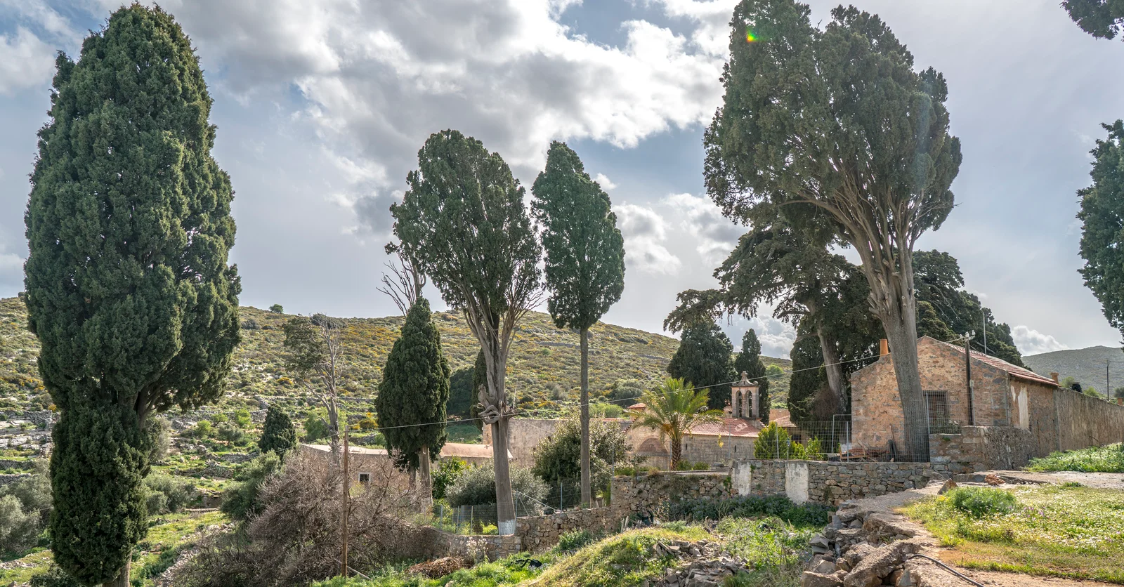
Moni Aretiou stands east of Karydi, among cultivated land, low rocky slopes and the villages around Fourni. It belongs to the inland landscape behind Elounda, away from the bay, harbour and coastal road.
The monastery is dedicated to the Holy Trinity. Over the centuries it developed as a working religious community, suffered destruction and went through several phases of repair and restoration.
Between Karydi and Fourni
The monastery stands east of Karydi, within the Fourni area and the wider Mirabello landscape north and inland from Elounda.
This location matters to the character of the site. Aretiou was not conceived as an isolated church alone. It developed as a religious community with land, working buildings, storage and accommodation. The monastery belongs to the agricultural and village geography behind the coast.
For a broader account of how the shoreline shaped Elounda itself, see A Short Chronological History of Elounda.
A foundation around 1600
The Holy Metropolis of Petra and Cherronisos dates the monastery to around 1600 and names Markos Papadopoulos as its founder. A regional historical account also connects Papadopoulos with Fourni and records his donation of property to the monastery.
The endowment was sufficient for twelve monks. That detail gives the foundation a practical scale: the donated land was intended to maintain a resident brotherhood, not simply to finance the construction of a church.
Its foundation is best placed around 1600, or at the end of the 16th century. The surviving accounts do not support a single exact year.
Notarial records cited by Orthodox Crete describe numerous 17th-century transactions with other monasteries and private individuals. They indicate that Aretiou became an established religious and economic institution within Mirabello during the century after its foundation.
A monastery arranged for worship and work
The complex follows the slope and is organised around two courtyards. In the smaller southern court, close to the main entrance, were working and service spaces including an olive press, wine press and stables. The principal courtyard contains the catholicon, the monks’ cells and the main residential spaces.
This division makes the monastery legible as a working settlement. Agricultural processing and animals were kept within the outer part of the complex, while worship and daily monastic life were organised around the inner court.
The catholicon stands near the centre and is dedicated to the Holy Trinity. A smaller chapel of Saint Lazarus lies nearby and may have served a funerary purpose, though this is not certain.
The arrangement shows how stone construction, courtyards and service rooms were combined in the older built landscape of eastern Crete. The scale is monastic, but the same response to terrain, work and enclosure also appears in village and agricultural buildings across the region.
Seventeenth-century painting
A school of icon painting operated at Aretiou during the 17th century. Important surviving icons of the Cretan School remain inside the catholicon: the Holy Trinity, the Lady of the Angels and Pentecost, attributed to the same anonymous painter.
Together, these works show that painting formed part of the monastery’s 17th-century religious life. Significant examples remained at the site despite the damage that followed in later centuries.
Destruction and repair
The monastery was attacked and burned during the uprising of 1821. The Holy Metropolis records the destruction of a substantial library that had preserved material from the Venetian period.
Repair came in stages rather than as a simple return to the earlier monastery. Bishop Dorotheos carried out a renovation in 1844, an event connected with an inscription on the episcopal throne. Further substantial maintenance followed in the early 1880s, including work on the catholicon and other buildings.
The monastery was designated for dissolution in 1930, reconstituted in 1955–56 and comprehensively restored during the 1990s. The complex is now described as restored, although its present fabric should not be assigned to a single building campaign or completion date.
What remains visible
The two-courtyard plan is still the clearest way to read Aretiou. The service spaces occupy the outer part of the complex, while the inner courtyard contains the catholicon and the principal residential buildings. The change in level follows the sloping ground rather than suppressing it.
Within this arrangement, a visitor can distinguish the principal church, the chapel of Saint Lazarus, the cells and the auxiliary spaces connected with agricultural work. Stone walls and enclosed courts give the complex a strong boundary, but describing it simply as a fortress would obscure its more practical organisation.
As of July 2026, the Holy Metropolis of Petra and Cherronisos lists Aretiou among its staffed monasteries. It should therefore be approached as an active religious place, not only as an architectural monument.
Visiting with restraint
No reliable public opening schedule could be confirmed in July 2026. Anyone making a special journey should confirm access directly with the Holy Metropolis of Petra and Cherronisos. Clothing and behaviour should be appropriate to an active monastery, and services or community routines should take priority over sightseeing.
Moni Aretiou lies inland from Elounda, around Karydi and Fourni. It belongs to the upper Mirabello countryside rather than the coastal sequence of Elounda and Plaka.
For another view of Mirabello’s upland settlements, the Vrouchas guide explains the village landscape north of Elounda.
Sources and Image Credits
- Holy Monastery of the Holy Trinity of Aretiou, Holy Metropolis of Petra and Cherronisos.
- Holy Monastery of Areti, Orthodox Crete.
- Episcopal Catalogue, Holy Metropolis of Petra and Cherronisos.
- Short History of Crete and the Lasithi Region, Regional Administration of Crete; the Moni Aretiou entry cites historical-archaeological material prepared for the former Prefectural Administration of Lasithi.
- Strategic Plan of the Municipality of Agios Nikolaos 2020–2023, Municipality of Agios Nikolaos.
- Hero image: Moni Areti (Crete)00(js).jpg by Jerzy Strzelecki, licensed under CC BY-SA 3.0. The original JPEG is cropped for the 16:9 hero display, resized and converted to WebP; this adapted version is shared under the same licence.
00(js).jpg)