
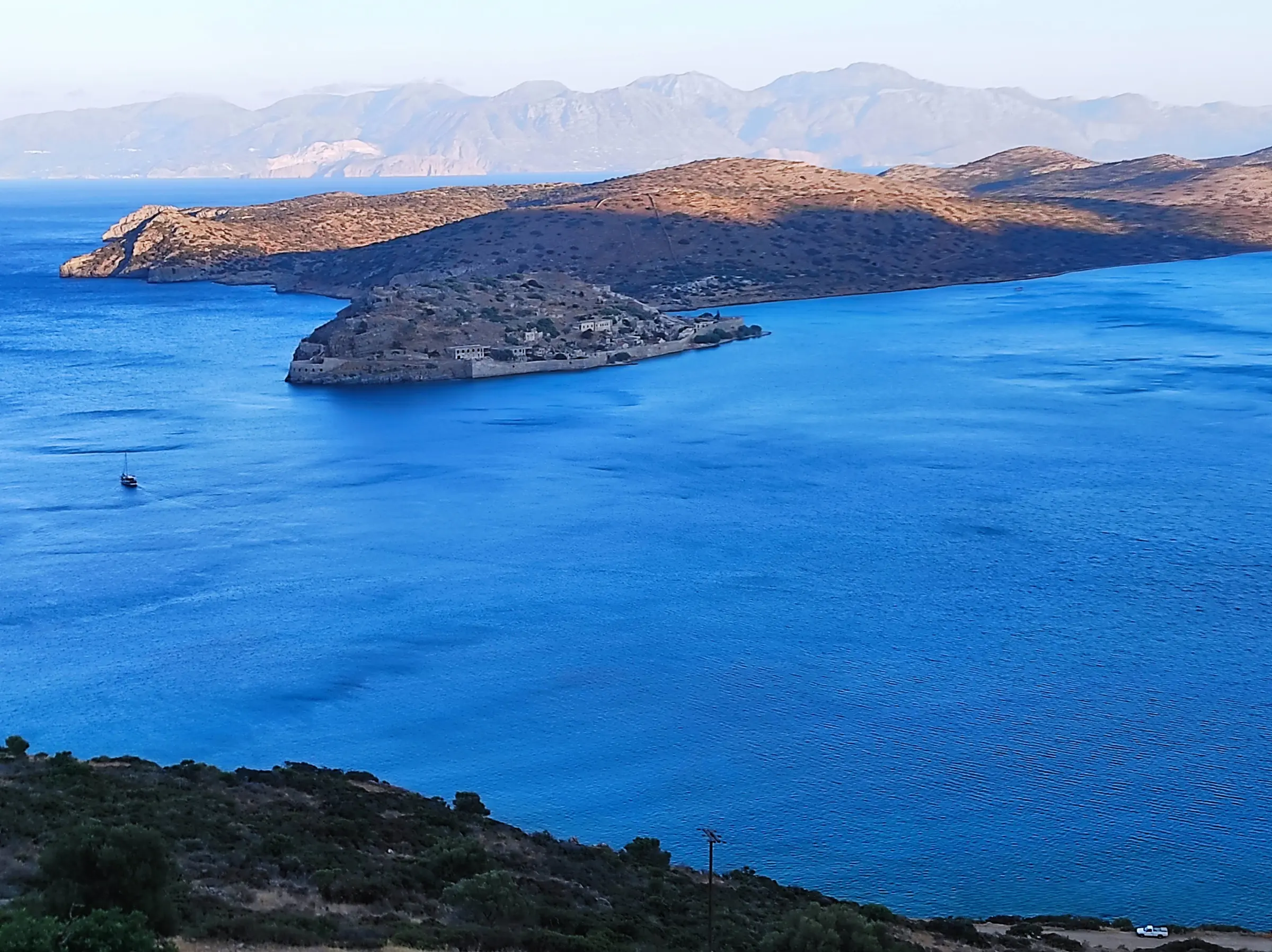
Spinalonga is not the remains of one historical episode. Its walls, streets and buildings record successive systems that reused the same confined island: defence, settlement, compulsory isolation, and later archaeological conservation and public memory. To understand why it was fortified, it helps to follow those changing uses—and its continuing connection with Elounda, Plaka and Mirabello Bay.
Spinalonga: a short historical documentary
A short visual introduction to Spinalonga’s changing role — from Venetian fortification and Ottoman settlement to compulsory isolation and a place of memory.
A small island in a strategic bay
Spinalonga is a rocky islet at the mouth of Elounda’s natural harbour. It faces Plaka and sits between the sheltered Gulf of Elounda and the wider approaches from Mirabello Bay. That position made it a useful place from which to watch movement through the bay long before the familiar Venetian works were built.
Ancient Olous belongs to the wider landscape around Elounda, not to a simple story of an ancient fortress on the islet. The Ephorate of Antiquities of Lasithi currently interprets an earlier wall on Spinalonga as probably seventh- or eighth-century CE. The safer conclusion is that the island mattered before Venice, while the exact earlier defensive history remains incomplete.
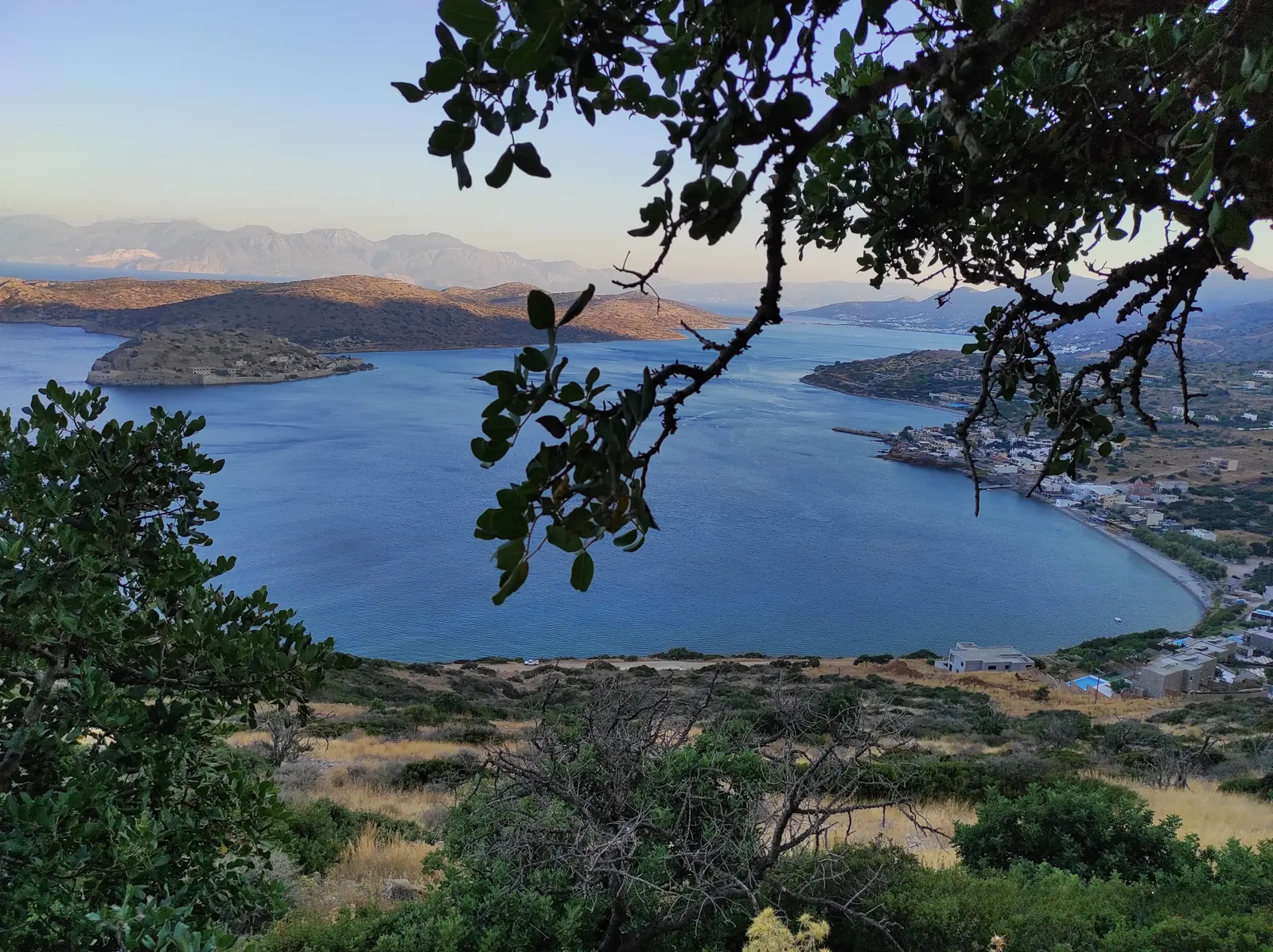
For the surrounding geography, see What Is Elounda? Understanding the Villages and Landscapes Around Mirabello Bay.
Why Venice fortified Spinalonga
Venice fortified Spinalonga within a wider late-sixteenth-century defensive programme in Crete, amid Ottoman pressure in the eastern Mediterranean. Construction began in June 1579. The island offered control of the harbour and nearby sea approaches, while salt production around Elounda formed part of the local strategic economy. The evidence does not support reducing the decision to one motive alone.
The fortress followed the terrain and the needs of artillery warfare. Genese Bressani was associated with an initial coastal enclosure. In 1584, Latino Orsini judged that scheme vulnerable from the nearby peninsula; later work added a higher defensive line along the ridge, connected to the lower works by transverse walls. Shore defences, upper walls, batteries, gates and cisterns therefore formed a single system rather than a collection of isolated ruins.
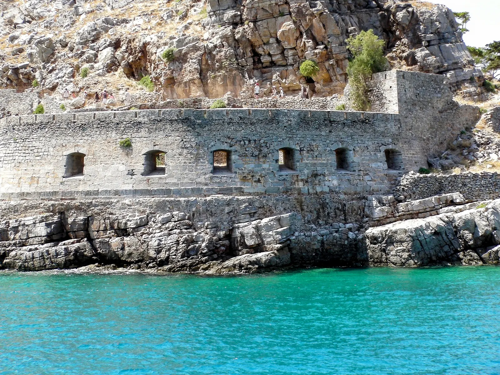
The fortification did not make the island independent of the coast. A fortress needed water, provisions, labour and communication, even though the records do not yet identify the mainland people who supplied those needs.
The design also explains why the walls still dominate the island’s appearance. A shore-level enclosure alone could be exposed from higher ground, so the ridge became part of the defensive problem. Bressani’s and Orsini’s different phases are useful precisely because they show an adjustment rather than a single finished plan: the fortress was repeatedly made to fit the land, the view lines and the changing expectation of attack. That physical logic survived later changes of population and use.
A Venetian enclave after 1669
When Candia fell to the Ottomans in 1669, Spinalonga remained Venetian, alongside Souda and Gramvousa. For several decades it was an enclave: a military position, but also an inhabited place in a changed political landscape. Its link to the sea was especially important.
The social history of this phase is less fully documented than its political outline. Available accounts establish continued Venetian control, but do not yet permit a detailed account of civilian numbers, supply routes or ordinary life inside the walls. On 4 October 1715, after a three-month siege, the fortress was surrendered to the Ottomans. More dramatic details often attached to the event have been left out because they require more direct archival evidence.
From fortress to Ottoman town
After 1715, Spinalonga did not become an empty relic. It developed into an inhabited Ottoman settlement, with soldiers and families, houses adapted to the fortifications, harbour activity, trade and community life. Stepped houses on the west and south sides and commercial activity near the waterfront show how a military enclosure became a town.
The precise scale of that town remains unsettled. UNESCO’s Tentative List submission reports 1,112 inhabitants in 1881, while published accounts sometimes give 1,111; the underlying census entry has not yet been inspected. Rather than select a disputed total, it is safer to say that the late-nineteenth-century settlement had more than a thousand residents. The same submission describes about 200 houses and 25 shops or workshops, figures that also await verification against census and property records.
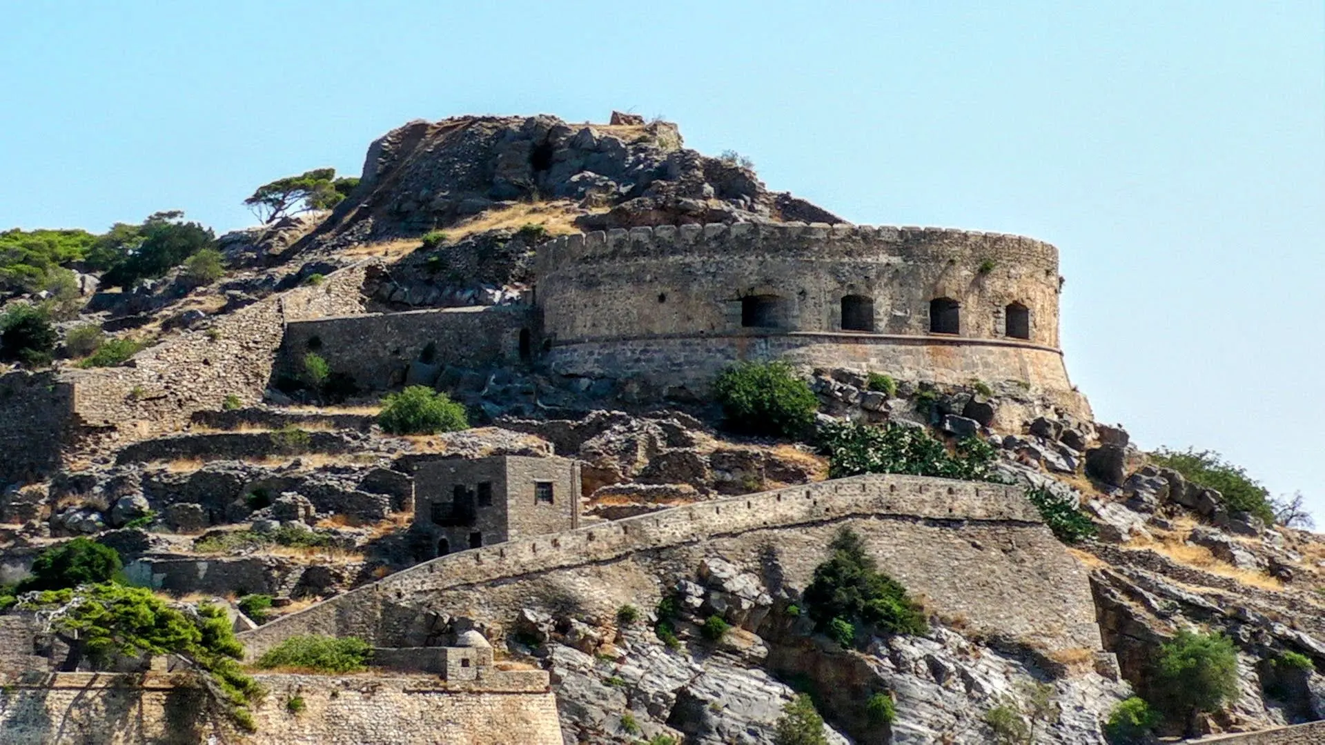
This phase complicates the island’s usual public image. The later isolation institution took over an already inhabited built environment; it did not begin on an unoccupied island.
The town was connected to the mainland in ways that a fortress narrative can obscure. Its harbour and commercial role placed the island in a regional network, but the detailed documentary record for particular merchants, workers and routes still needs to be assembled. That gap matters. It is one reason the Ottoman period should not be treated merely as an interval between Venetian rule and the leprosarium, or as a backdrop without residents of its own.
Why the Cretan State chose Spinalonga
In 1903, the Cretan State selected Spinalonga for the compulsory isolation of people with leprosy, now more commonly called Hansen’s disease. The choice reflected public-health assumptions of the period, separation from the mainland and housing left by the changing Ottoman settlement. The Ephorate’s account also connects the decision with the removal of the remaining Muslim residents.
A sequence of Cretan State measures created the isolation regime. Later sources identify individual laws and decrees, but the original Gazette pages have not yet been obtained and inspected. This article therefore does not present exact legal titles, page references or administrative procedures as settled fact.
The first transfers in 1904
The first compulsory transfers took place in 1904. Later accounts commonly give a total of about 250 people and dates in mid-October, but the original transfer record has not yet been located. The year, rather than a disputed day or count, is the secure point.
The new institution reused existing streets and houses, but its purpose was fundamentally different from that of the Ottoman town. It imposed separation on people diagnosed with Hansen’s disease. That compulsory character should not be softened, even though residents also created households, relationships and collective forms of organisation.
The distinction between institutional policy and lived experience is important. A site chosen for isolation could still contain work, mutual support and daily decisions made by the people living there. Those forms of agency do not make compulsory separation benign. They show instead how residents responded to circumstances imposed on them.
Life inside the settlement
Early provision of food, housing and medical care was inadequate. The institution was created to isolate, not to cure, and the first years should not be described as though conditions remained unchanged throughout its existence.
Over time, residents made a community within severe limits. They lived in inherited buildings, maintained streets and services, and organised collectively for improvements. A 1939 inscription records the opening of a perimeter road by the Brotherhood of the Sick of Spinalonga under the presidency of Epaminondas Remoundakis. It is a small but important piece of evidence for resident agency.
The surviving records do not support confident claims about exact allowances, marriage procedures, electricity, school provision, escape totals, mortality or individual family routines. Those omissions are deliberate. A fuller social history will depend on resident testimony, institutional records and local archives.
This restraint also avoids turning the island into a single story of suffering. The early institutional conditions were harsh, but the later record includes organisation and material change. Equally, the current evidence does not permit a smooth story of improvement. The purpose here is to keep both parts visible: the coercive system and the residents’ capacity to make claims, organise and maintain a community within it.
Plaka, Elounda and the island’s supply line
Spinalonga could never function without the mainland. Plaka, Elounda and the surrounding coast were part of its practical world: people, supplies, officials and visitors crossed the water, while the island remained visible from shore. That relationship changed with each historical use—from maritime defence and Ottoman trade to a state institution separated by medical policy and stigma.
What has not yet been recovered is the detailed local record: boat licences, supply contracts, harbour registers, payrolls, family archives and named accounts of the people who did this work. It would be easy to fill the gap with familiar stories about boatmen or deliveries. The available evidence does not justify doing so. At the scale the sources support, the island depended on mainland connections, and Plaka and Elounda were shaped by their proximity to it.
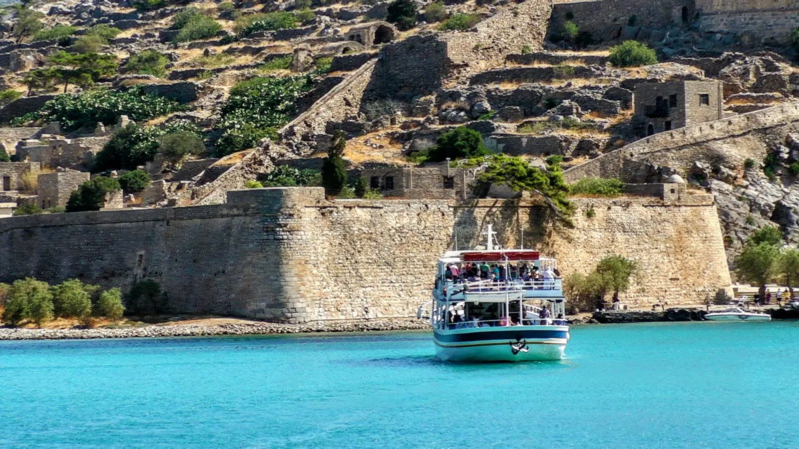
For wider local context, see A Short Chronological History of Elounda, Welcome to Elounda Traditional Homes and Elounda Beaches: A Practical Guide to the Coast, Plaka and Kolokytha.
Treatment, change and closure
Sulfone treatment changed the medical context in the late 1940s. It did not erase the effects of earlier isolation or stigma, but it altered what was possible and weakened the rationale for permanent segregation. The precise treatment records and protocols for Spinalonga remain to be located, so this article does not make more detailed clinical claims.
The institution closed in 1957. Accounts of the exact closure month, final transfer total and last person to leave vary, and none has been used as fact here. Closure ended the formal institution, but not the human consequences of decades of compulsory isolation.
The later history of the island was therefore not a clean transition from medical institution to monument. Buildings were left without their former purpose, residents’ histories became subject to public retelling, and the material traces of the leprosarium were altered by later demolition and conservation. That sequence affects what can be seen today and what must be recovered through records and testimony rather than architecture alone.
From abandonment to protected monument
After 1957, Spinalonga was abandoned. Its later conservation has involved difficult choices about what survives and what is made visible. A government cultural record notes that much of the organised construction from the leprosarium period was demolished in the 1980s. The physical record is therefore selective: absence is part of the history as well as surviving walls, houses and paths.
Today Spinalonga is an archaeological monument and a place of public memory. It is on Greece’s UNESCO Tentative List, not the World Heritage List. In 2021, Greece’s nomination was withdrawn at the request of the State Party. Tentative listing and World Heritage inscription are not the same thing.
The island’s public interpretation has to hold several histories together. The Venetian works are visually dominant; the Ottoman town makes the interior legible as a settlement rather than only a garrison; and the leprosarium demands an account that is respectful without making illness the sole identity of every resident. Conservation cannot restore every lost layer, but it can make the succession of uses easier to read.
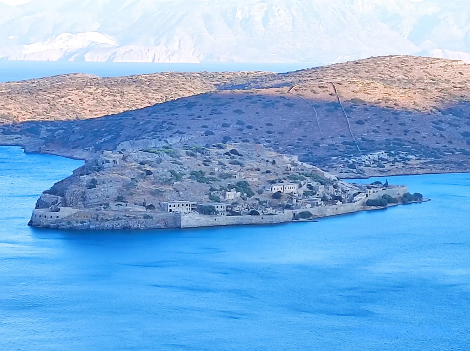
What the island’s successive lives reveal
Spinalonga’s history is best read through reuse. The same constrained island served as a strategic position, Venetian fortress, Ottoman town, compulsory settlement and protected archaeological site. Each period adapted walls, streets, buildings and crossings to a different social purpose.
That is why the island remains inseparable from Elounda, Plaka and Mirabello Bay. Its boundaries were never simply water and stone. They were also made by the people, supplies, work and decisions that connected it to the mainland—and by the institutions that tried to control those connections.
A note on evidence
Original records have not survived, or have not yet been located, equally for every period. Some published dates and totals conflict; where that precision is unresolved, this article qualifies it, gives the broader supported account or leaves it out. Archival enquiries remain active, and the article will be revised when original records or documented local testimony add clarity.
Sources and Image Credits
- The construction phases, Ephorate of Antiquities of Lasithi.
- Ottoman times, Ephorate of Antiquities of Lasithi.
- Modern times, Ephorate of Antiquities of Lasithi.
- Opening of the perimeter road—Remoundakis inscription, Ephorate of Antiquities of Lasithi.
- Stavrakakis, N., “The living conditions and care of the lepers on the islet of Spinalonga”, Archives of Hellenic Medicine 39(3), 397–409.
- At the Spinalonga leprosarium: history and memory, Greek digital-culture platform.
- Fortress of Spinalonga, UNESCO World Heritage Centre Tentative List, and Decision 44 COM 8B.19, UNESCO World Heritage Committee.
- All photographs: Nikos Pasparakis / Elounda Traditional Homes of Crete. The modern boat photograph is used as contemporary context only.