
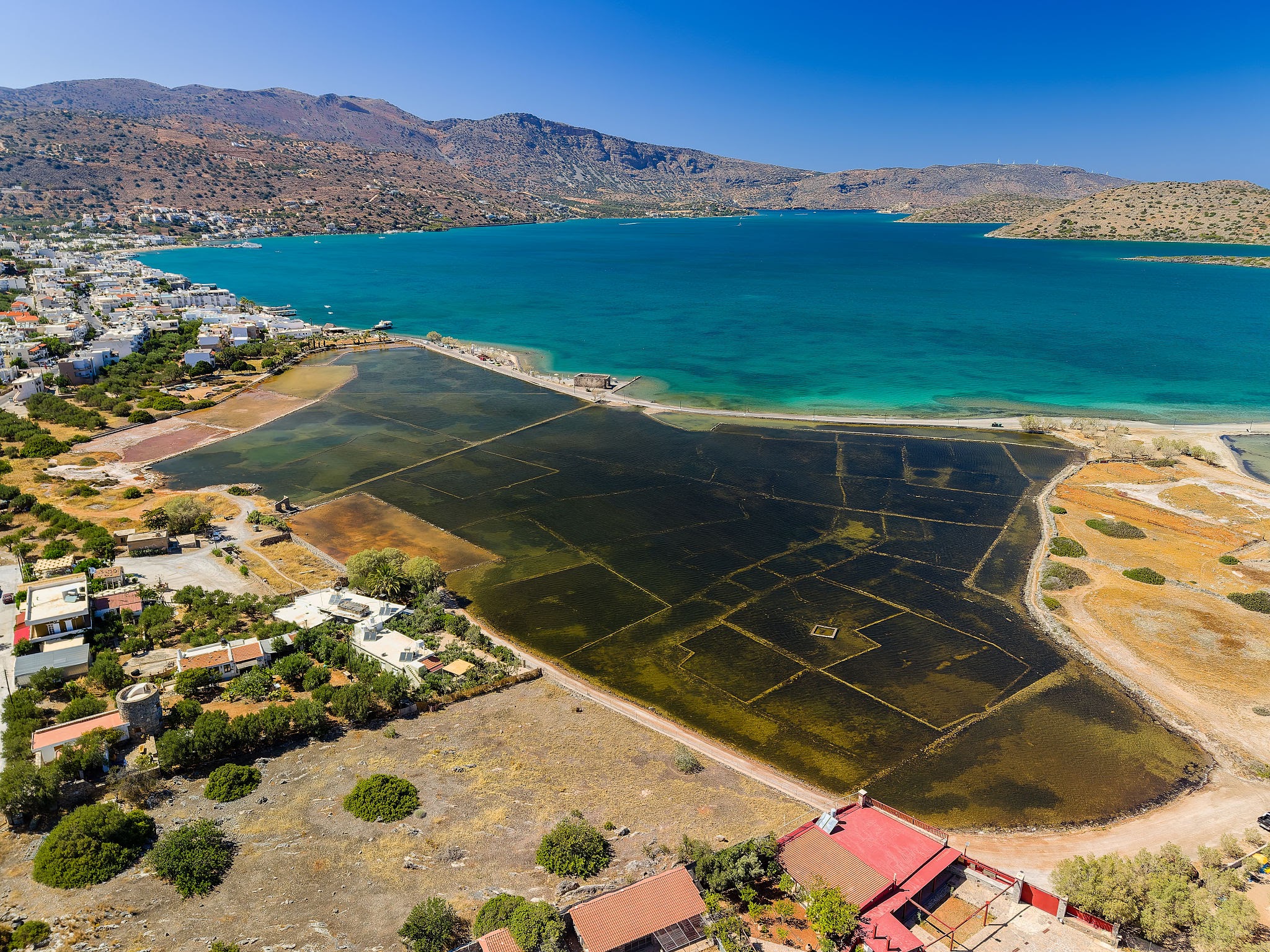
The road from Elounda toward the Kolokytha side passes through one of the most useful places for understanding the area. There is water on both sides, the old salt-pan landscape is close by, and the Poros windmills stand near the canal.
It is a modest place, but it explains more than a viewpoint alone. It shows Elounda as a working shoreline.


Why Salt Mattered Here
The Ephorate of Antiquities of Lasithi records that salt pans in the cove of the Gulf of Elounda may date from the Byzantine period. The Venetians used them from the early period of their rule in Crete, and production intensified after Cyprus was lost in 1571 and Spinalonga was fortified in 1579.
The detail is important because it keeps Elounda’s history practical. Salt was not decorative. It was work, storage, trade, and control of a useful coastal resource.
Two Salt-Pan Areas
The same official source describes two complexes: one in Mesa Elounda, partly preserved today, and a smaller one in Oxo Elounda, around the site of the modern settlement of Schisma. It also describes a system of sedimentation tanks with gradually reduced depth.
That kind of information changes how the lagoon looks. The flat water and low ground are not empty. They are part of an older working system, shaped by the needs of salt production and local labor.
Workers and Village Growth
The source also notes that workers in the salt pans came mostly from Fourni villages, and that today’s coastal villages of Elounda developed from the land used for their accommodation.
This gives the salt pans a human scale. They are not only a Venetian or archaeological topic. They are connected with ordinary work and with how settlement along the coast grew over time.
The Poros Windmills
Near the canal, three windmills stand by the sea. The Ephorate describes them as round windmills with local stone masonry, built at the beginning of the 20th century and now listed as historical preserved monuments.
Most windmills are associated with higher ground. These are different because they sit close to the water, where the canal, lagoon, road, and older working landscape meet.
How to Read the Place Today
Walk slowly near the canal and look at the relationship between water, road, and low land. The interest is not in a single monument. It is in the way several practical features sit together: salt pans, windmills, canal, bridge, lagoon, and the route toward Spinalonga.
For the wider geography of Elounda and Mirabello Bay, begin with the area guide. For the wider historical context, read Elounda History Through Its Shoreline. For present-day route planning around Mavrikiano, Olous, and Spinalonga, use the Mavrikiano Distances and Area Guide.
The salt pans and windmills show an Elounda built through use. That is the part worth keeping visible.
Sources and Image Credits
- Salt Pans, Ephorate of Antiquities of Lasithi.
- Windmills in Poros, Ephorate of Antiquities of Lasithi.
- Photo credited in caption from Wikimedia Commons.