
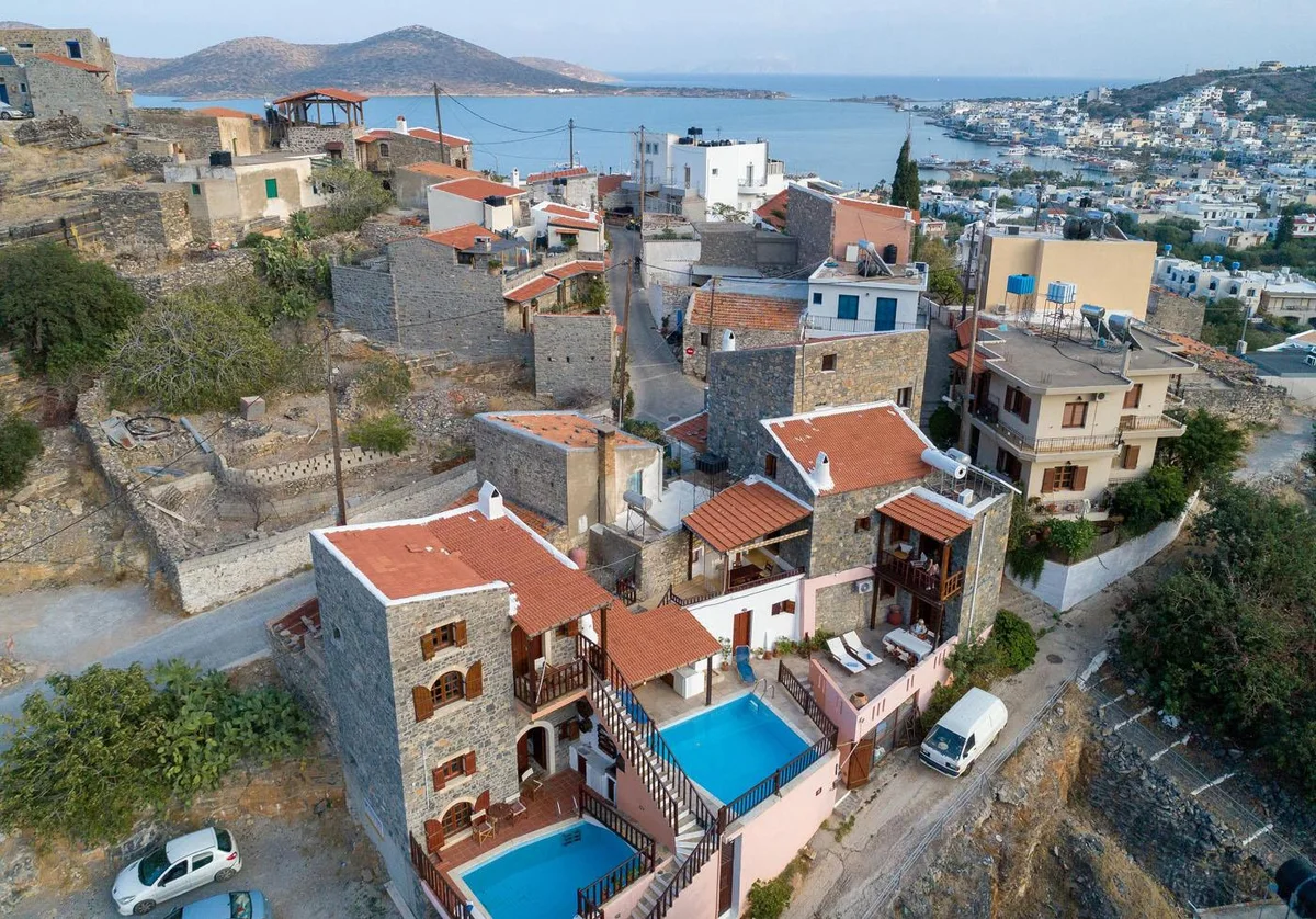
Around Elounda, walking changes character quickly. A stone lane in Mavrikiano can lead towards open hillside tracks; the road past the salt pans reaches the low, rocky ground of Kolokytha; Vrouchas looks towards a wind-exposed headland; and the old routes around Pines descend into the more enclosed ground of Havgas Gorge. For the settlement and coastal context behind these routes, see the wider Elounda-area geography.
These are not four versions of the same outing. They differ in surface, shade, exposure and how confidently a visitor can follow them. This comparison is intended to help with that first decision. It is not a turn-by-turn route guide, and it does not treat a line walked by an organised mountaineering club as automatically suitable for an independent visitor.
Four landscapes at a glance
| Area | Straightforward walking | Where the character changes | Main planning issue |
|---|---|---|---|
| Mavrikiano and the lower Oxa slopes | Village lanes, stone paths and obvious lower tracks | Steeper mountain paths towards Oxa | Do not confuse a village-and-track walk with a summit ascent |
| Kolokytha Peninsula | Road and broad dirt-track sections near Poros and the central peninsula | Narrow rocky paths; an extended coastal section is described as unmarked | Choose a clear turnaround rather than assuming a complete circuit |
| Vrouchas towards Aforesmenos | Rural road and dirt-road approach in the wider headland landscape | Rocky or narrow trail sections closer to the exposed coast | Wind, limited shade and uncertain continuity from Vrouchas |
| Havgas between Pines and Plaka | Village stone paths and agricultural road | Rough gorge bed, vegetation and variable old path | Confirm current access and condition, especially after rain |
The table deliberately avoids time, distance and difficulty ratings. Published figures vary, and they have not been independently checked against a current route survey. On this terrain, an apparently short distance can also say little about loose stone, brush, wind or route-finding.
1. Mavrikiano and the lower Oxa slopes
Mavrikiano is the most adaptable of the four starting landscapes. The village sits above Elounda, with stone paths, quiet lanes and roads that rise away from the waterfront. A walk here can remain close to houses and familiar surfaces, or continue onto the agricultural tracks of the lower hillside.
That flexibility is useful, but it needs a clear boundary. “Walking above Mavrikiano” should not be used as shorthand for climbing Oxa. Mountaineering-club accounts of Oxa describe farm-road or dirt-road approaches followed by steeper paths. A local club report calls its final ascent demanding and records strong wind higher on the mountain. Those are mountain-route characteristics, even when the beginning feels like an extension of the village road.
For a simple walk, the defensible idea is an out-and-back exploration of the village and obvious lower tracks, with the return made before the surface becomes steep, narrow or unclear. This leaves room to notice the practical transition in the landscape: closely built village fabric gives way to retaining walls, cultivated ground and more open views across Elounda. It also allows the length to be adjusted without committing to an uncertain circuit.
Current summit-route markings cannot be assumed from older reports. One club observed good waymarking on an Oxa route in 2022, but no current inspection covering the proposed lower-slope walk was found. Faded signs, a track on a digital map or a visible line used by goats are not equivalent to a maintained pedestrian route.
The Mavrikiano area guide gives the broader village context. Here, the boundary is narrower: lanes and broad lower tracks can support ordinary walking, while the mountain above requires a separate plan, suitable footwear and reliable navigation.
2. Kolokytha Peninsula
Kolokytha begins with a legible piece of Elounda’s coastal geography. The approach passes the salt-pan landscape and Poros windmills before reaching the peninsula side. The salt pans and Poros windmills article explains why this low ground is more than an incidental approach to the coast.
On the peninsula, broad dirt road and visible paths make some sections look uncomplicated. A local mountaineering-club loop used dirt road, uphill path, a narrow marked path and rocky coastal ground before returning by road. That sequence shows why “a walk on Kolokytha” needs more definition: the surface can change several times within one outing.
The central safety distinction concerns the longer circuit. A regional route guide describes signed or visible sections, but it also identifies a later coastal traverse with no path or signage, over rocks beside the sea. The same guide does not recommend that passage for beginners and suggests returning by the marked route instead. This article does not provide directions to the unmarked section.
The simpler way to understand Kolokytha is therefore as a track-and-return landscape, not as a circuit that must be completed. A visitor can stay with a broad, obvious approach and reverse the walk when the route narrows, the marking becomes uncertain or the ground no longer matches their footwear and experience.
There is little protection from the wider conditions on the open peninsula. Sun, reflected light and wind can matter more than elevation. In strong wind, a coastal path can become uncomfortable well before it looks technically difficult, while loose rock close to the shore leaves less room for an error. Greek Civil Protection advises avoiding shore and coastal activities during gale-force winds; that guidance takes priority over an intended walking plan.
3. Vrouchas towards Aforesmenos Lighthouse
The northern headland is different again. Vrouchas sits higher and farther north than Mavrikiano, while Aforesmenos Lighthouse stands near the rugged coast beyond the village. The Municipality of Agios Nikolaos visitor site describes the lighthouse approach from the wind-farm side as a dirt road followed by a short trail. It also characterises the area as barren, rugged and notably windy.
That short approach should not be confused with every route carrying the label “Vrouchas to Aforesmenos.” The Agios Nikolaos Mountaineering Club has documented longer outings from near Vrouchas and from Plaka, using old rocky coastal paths, narrow trail and rough passages. These were led group walks. They show that a longer connection exists as a route concept, but they do not confirm that it is continuously marked, unrestricted or suitable for a visitor setting out alone.
The headland has very little dependable shade. A club report from October 2025 records strong midday heat and walkers finding limited shelter behind rocks or the small Agios Ioannis church. The same open ground can receive substantial wind. A forecast that feels manageable in the village may have a different effect closer to the cape.
This makes Aforesmenos a route for conservative decisions. If the intention is simply to see the headland landscape, the shorter documented approach from the wind-farm side is a different proposition from attempting the full line from Vrouchas. Neither should be started on the assumption that older waymarking or access information remains unchanged.
The Vrouchas area guide provides useful context for the village. The walking question remains separate: before attempting the longer route, current access, wind, marking and the condition of the narrow coastal sections need local confirmation.
4. Havgas Gorge between Pines and Plaka
Havgas offers the most enclosed landscape in this comparison, but enclosure does not make it an easy alternative to the exposed coast. Local mountaineering-club reports document routes linking Pines, the gorge and the ground above Plaka. They describe broad old stone paths, agricultural road, walled tracks and a rougher line through the gorge.
The route is shaped by old connections between the upper Mirabello villages and the coast. That history remains visible in stone boundaries and path construction, but an old route is not necessarily a maintained one. In June 2022, the local club reported low vegetation and branches obstructing parts of the way. A 2025 club outing confirms that led groups still walk through the wider Havgas landscape, yet it does not amount to a current condition report for independent walkers.
This is where the distinction between a walk and a gorge route matters. Village paving and agricultural road may be clear; the gorge bed can involve uneven stone, vegetation and route-finding. Conditions can change after heavy rain, even if the bed appears dry on arrival. No current official inspection was found that confirms the whole route is open and clear.
Havgas should therefore be considered only after checking locally with a competent route source. It should not be entered during severe weather, when rain is expected, or when recent rain may have altered the bed and banks. If current information is unavailable, the uncertainty is itself a reason to choose one of the more reversible village or broad-track options.
This article refers only to the Havgas route between Pines and Plaka. Other Cretan gorges with the same or a similar name are outside its scope.
Season, heat and the time of day
The four landscapes are exposed in different ways, but none is insulated from heat. Mavrikiano offers buildings and the possibility of a short return. Kolokytha and Aforesmenos have long open sections. Havgas may provide some enclosure or vegetation, yet its approaches and return can still be hot.
Greek Civil Protection advises avoiding long walks or running under the sun during a heatwave and drinking ample fluids. On a heatwave day, changing the departure time does not turn an exposed route into a sound plan. A short village walk may remain possible depending on official advice and personal health, but the longer peninsula, headland and gorge ideas should be deferred.
Outside heatwave conditions, a cooler part of the day can reduce sun exposure, provided there is enough daylight for an unhurried return. Spring and autumn club reports show why season labels alone are insufficient: an October Aforesmenos outing still encountered strong midday heat, while wind affected several walks in other months. Check the day’s forecast rather than relying on the calendar.
Carry water from the start. Do not assume that a chapel, beach or rural track has a working public supply. Sun protection and a light extra layer for wind are practical on open ground, but equipment does not compensate for unsuitable weather.
Wind, footwear and route marking
Wind changes the comparison most sharply on Kolokytha and Aforesmenos, where the ground is open and the coast is close. It can also be strong on Oxa and around Pines. When gale-force winds are forecast, Greek Civil Protection advises avoiding coastal activities. On less severe but still windy days, a sheltered village walk can be a more controlled choice than an exposed headland.
Footwear should follow the surface rather than the route’s reputation. Ordinary supportive walking shoes may be sufficient for paved village lanes. Dirt, gravel, loose stone and gorge beds call for closed footwear with a secure, grippy sole. Open sandals and flip-flops do not provide the same footing or protection on rocky paths.
Waymarking remains the largest shared uncertainty. Sources from different years describe marked paths in places, faded or intermittent signs elsewhere, and sections with no path at all. Before leaving the straightforward surface:
- confirm the current route and access with a competent local source;
- carry an offline map, while remembering that a mapped line may not be maintained or publicly accessible;
- tell someone which landscape you intend to walk and when you expect to return;
- turn back when the surface, exposure or route-finding no longer matches the plan.
Walking around Elounda is most useful when these distinctions remain visible. Mavrikiano offers a reversible village-and-hillside walk; Kolokytha moves from broad track to rocky coast; Aforesmenos is defined by exposure; and Havgas depends on the condition of an old gorge route. Choosing between them is less about collecting four routes than about reading the ground and leaving the uncertain sections for another day.
Sources and Image Credits
- Location: Mavrikiano & Vrouchas, Elounda, Elounda Traditional Homes of Crete.
- Ellinika to Mt Oxa to Elounda, Heraklion Mountaineering Club.
- Πανσέληνος στην Οξά, Ελούντα, Agios Nikolaos Mountaineering Club.
- Πεζοπορία στη χερσόνησο Κολοκύθας, Ελούντας, Agios Nikolaos Mountaineering Club.
- Kolokitha Peninsula, circular path, East Crete Travel Guide.
- Salt Pans, Ephorate of Antiquities of Lasithi.
- Lighthouse of Cape of Agios Ioannis or Aforesmenos, Municipality of Agios Nikolaos visitor site.
- Πλάκα Ελούντας, Βρουχάς, Μυρωνικήτας, Αφορεσμένος, Agios Nikolaos Mountaineering Club.
- Πεζοπορία Άνω Πινές, Φαράγγι Χαυγά, Πλάκα Ελούντας, Agios Nikolaos Mountaineering Club.
- Ελούντα, Πινές, Τσιφλίκι, Agios Nikolaos Mountaineering Club.
- Heatwave and Stormy Winds, Hellenic Ministry for Climate Crisis and Civil Protection.
- Hike Smart, US National Park Service.
- Hero image: “Mavrikiano village above Elounda Bay,” owned by Elounda Traditional Homes of Crete and already held in the repository.